A column by Bruce Uzelman
In the 1850s, prospectors began to drift into the Boundary and Cariboo regions of British Columbia. Gold was first discovered on the Pend d’Oreille River near Trail in 1854, and on Rock Creek east of Osoyoos in 1859. Miners crossed the American border into the new Colony of B.C. in numbers.
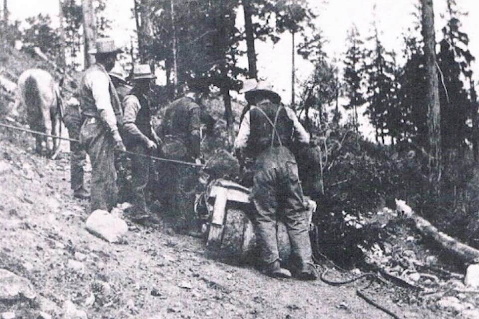
The miners were looking for placer gold, found in creeks or rivers or on adjoining hillsides. It was easier to access and required less equipment than did hard rock mining. The town of Rock Creek quickly sprung up, initially a few saloons and cabins, a store and a hotel. At the town’s height, thousands of miners, many of them from the United States, surged into the area.
The colonial government in Victoria was alarmed with the large American presence, the lack of food and supplies, and the disorder and violence of the “Rock Creek War.” Governor Douglas dispatched officials to collect duties on incoming American goods and to enforce the law. When the new gold commissioner was unable to stem the brutality, an imposing Douglas arrived on horseback in full uniform. He threatened to call in 500 British Marines. The discord promptly subsided!
Douglas determined a trail was essential to protect British sovereignty and to secure the trade, most of which had been conducted with the U.S. He enlisted the Royal Engineers to survey a route, and Edgar Dewdney to construct the trail. By 1861, the trail reached Rock Creek. But the gold rush there was pretty much over. Most miners had migrated to newer discoveries.
Douglas’s selection of Dewdney to construct the road was a good choice. He was an engineer, who had immigrated from Wales in 1859. He led the survey of the trail, and supervised construction to Rock Creek, and later to Wild Horse Creek in the East Kootenay.
Gold was found on the creek in 1863. The governor of the new Colony of British Columbia, Frederick Seymour, in 1864 authorized the extension of the trail to the Wild Horse. Colonial Secretary Birch, later in the year, travelled to the creek. He wrote to the governor that it took 26 days from Hope to complete the trip over rough, inadequate trails, and required a diversion through U.S. territory.
Birch estimated 700 miners were along a four mile portion of the creek and 300 prospectors were nearby. He said mining on the creek was “paying well.” Birch relayed that the gold traders expected, “a rush of from 10,000 to15,000 miners from the Boise [Idaho] country in the spring, and that large supplies [from the Washington and Oregon territories] are still being sent into the mines.”
Sam McBride, a writer of Kootenay history, wrote, “in addition to building the trail, Edgar was on a mission of discovery and reconnaissance for a governor extremely curious about economic prospects for a land they were about to access through a west-east route….”
Indeed, the governor provided written instructions to Dewdney to make “full notes” of the resources, “the soil and the timber, … the quantity and probable extent of prairie and grazing land, the nature of different rock….” The governor, as well, wanted extensive geographical detail. He was clearly keen to develop the hinterlands of the colony.
Dewdney took notes as he explored the region and routed the trail. He wrote, for example, that Kootenay Lake, “abounds in minerals, iron and large quantities of galena with which I [feel] satisfied there is silver….” He apparently anticipated the significance of the mineral wealth in the Kootenays.
Dewdney, later related that he had blazed the trail as he travelled east in 1865. Much of that route is now shared with Highway 3. That speaks to Dewdney’s abilities. Many towns and cities grew up along the way, Princeton, Osoyoos, Grand Forks, Rossland, Creston and Cranbrook, to name a few.
Dewdney described Wild Horse Creek, in a 1901 interview archived by the Columbia Basin Institute, “The diggings proved to be rich, over a million dollars worth of dust having at that time [1865] been taken out. A typical mining camp, with scores of saloons and dance halls, had sprung up at the mouth of the creek. Some years later the place was named Fort Steele….” On his return trip, Dewdney related, he recruited contractors to build the trail.
“Suffice it to say,” he added, “that by September, or seven months from the time the survey left Fort Hope, the trail was completed and the merchants of the coast were sending in supplies by pack trains, through British territory, a distance of some 500 miles.” He may have exaggerated a little. Some sources suggest the trail was completed in mid-1866, and put it at 400 or 450 miles.
Nonetheless, the Dewdney Trail was a monumental achievement. It extended from Fort Hope to Wild Horse Creek, ensuring colonial governance and order for the southern interior, and linking coastal centers with the frontier boomtown of Fort Steele. Fort Steele declined as the placer rush of the 1860s faded, but it reemerged in the 1890s. The two golden eras of Fort Steele in Part 2.
Bruce Uzelman, based in Kelowna, holds interests in British Columbia history as wells as current political and economic issues.
Bruce had a career in small business, primarily restaurant and retail. He holds a Bachelor of Arts, Advanced from the University of Saskatchewan, with Majors in Political Science and Economics.
Contact: urban.general@outlook.com